


Gillan Precinct, Dawson County, Nebraska
About
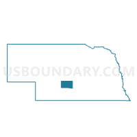
Outline

Summary
| Unique Area Identifier | 612706 |
| Name | Gillan Precinct |
| County | Dawson County |
| State | Nebraska |
| Area (square miles) | 131.88 |
| Land Area (square miles) | 131.70 |
| Water Area (square miles) | 0.18 |
| % of Land Area | 99.87 |
| % of Water Area | 0.13 |
| Latitude of the Internal Point | 40.96009030 |
| Longtitude of the Internal Point | -99.92824290 |
Maps


Graphs
Select a template below for downloading or customizing gragh for Gillan Precinct, Dawson County, Nebraska


Neighbors
Neighoring Voting District (by Name) Neighboring Voting District on the Map
- Coyote Precinct, Dawson County, NE
- Cozad East Precinct, Dawson County, NE
- Cozad West Precinct, Dawson County, NE
- Fairview Precinct, Dawson County, NE
- German Precinct, Dawson County, NE
- Gothenburg East Precinct, Dawson County, NE
- Grant Precinct, Custer County, NE
- Kennebec Precinct, Dawson County, NE
- Wood River Precinct, Custer County, NE
Top 10 Neighboring County Subdivision (by Population) Neighboring County Subdivision on the Map
- Cozad city, Dawson County, NE (3,977)
- Coyote precinct, Dawson County, NE (550)
- Gillan precinct, Dawson County, NE (475)
- Gothenburg precinct, Dawson County, NE (353)
- Wood River township, Custer County, NE (326)
- German precinct, Dawson County, NE (261)
- Fairview precinct, Dawson County, NE (250)
- Kennebec precinct, Dawson County, NE (183)
- Cozad precinct, Dawson County, NE (152)
- Grant township, Custer County, NE (61)
Top 10 Neighboring Place (by Population) Neighboring Place on the Map
Top 10 Neighboring Unified School District (by Population) Neighboring Unified School District on the Map
- Lexington Public Schools, NE (12,327)
- Cozad City Schools, NE (5,227)
- Gothenburg Public Schools, NE (4,528)
- Callaway Public Schools, NE (1,294)
- Sumner-Eddyville-Miller Schools, NE (947)
Top 10 Neighboring State Legislative District Upper Chamber (by Population) Neighboring State Legislative District Upper Chamber on the Map
- State Senate District 36, NE (37,224)
- State Senate District 44, NE (33,011)
- State Senate District 43, NE (31,106)
Top 10 Neighboring 111th Congressional District (by Population) Neighboring 111th Congressional District on the Map
Top 10 Neighboring Census Tract (by Population) Neighboring Census Tract on the Map
- Census Tract 9683, Dawson County, NE (4,088)
- Census Tract 9718, Custer County, NE (2,827)
- Census Tract 9680, Dawson County, NE (2,584)
- Census Tract 9686, Dawson County, NE (1,573)
- Census Tract 9681, Dawson County, NE (1,494)
Top 10 Neighboring 5-Digit ZIP Code Tabulation Area (by Population) Neighboring 5-Digit ZIP Code Tabulation Area on the Map
- 68850, NE (12,295)
- 69130, NE (5,307)
- 69138, NE (4,489)
- 68825, NE (1,024)
- 68860, NE (324)
- 68834, NE (226)
- 69171, NE (26)